Finding your way in a train station, airport or shopping center is not always easy. Indoors, but also for pedestrians, a navigation as seen in cars often is unable to find the exact location or any location at all, as e.g. a clear road network with lanes is missing or "left" and "right" cannot reliably be detected.
In cooperation with Lucerne University of Applied Sciences (HSLU) as a research partner, the SBB as an industrial partner and the Swiss Commission for Technology and Innovation, Netcetera has developed an app for the iPhone that works using landmarks. Research at HSLU showed that a navigation system based on visual reference points provides a better basis for orientation inside buildings than a map. In the same way as verbal directions, navigation using landmarks makes use of easily recognizable visual features as points in a route network, so that travelers inside the station are guided from their starting point to their destination.
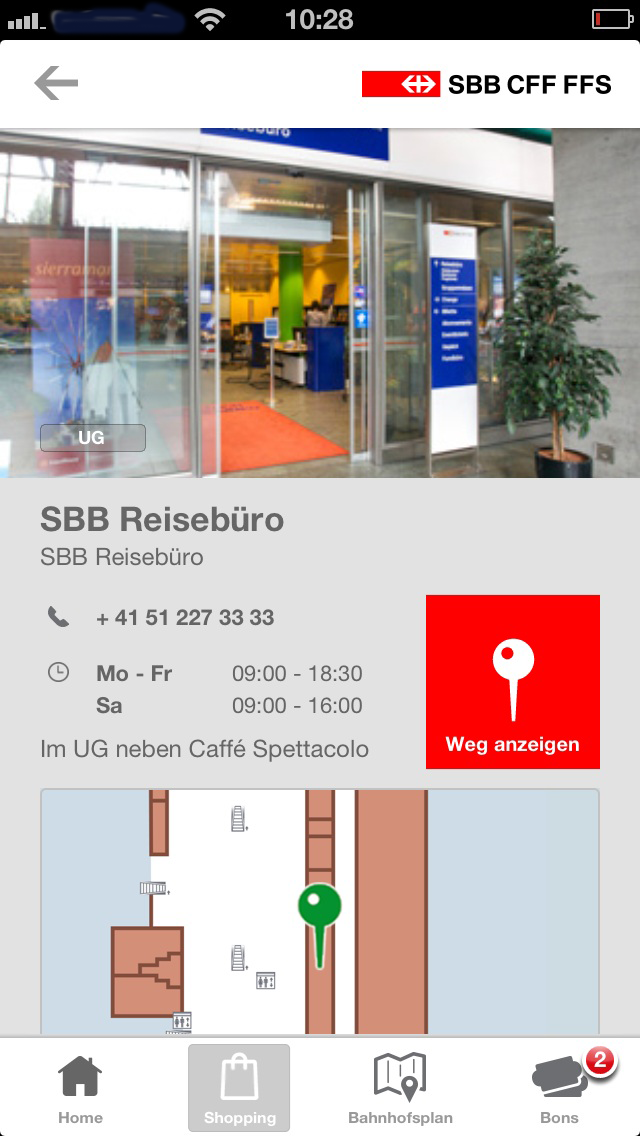
The Lucerne Station app is based on an editable route network accurate to within a meter and can be dynamically adapted according to current knowledge. This makes it possible to temporarily recommend a different route if necessary, for example if a special event is taking place. The database is consulted when you select "Show the way" in the app, and it visually shows the way from A to B.
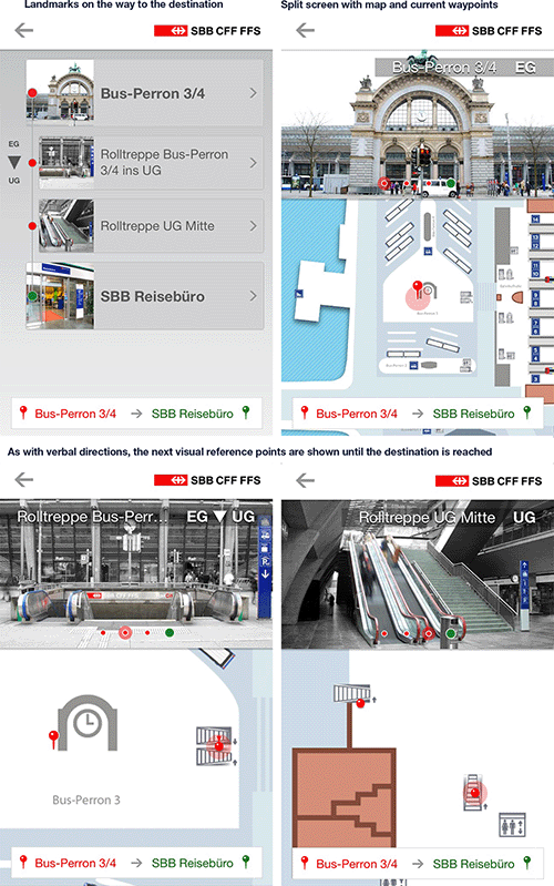
First you see an overview of all landmarks, including moving from one floor to another, inside the station. Details can be accessed from every point in this overview. A split screen shows an enlarged view of the next landmark, along with a map with the two current waypoints on the station floor plan. As with verbal directions, the next visual reference point is also shown on a map section.
This innovative approach to indoor navigation is currently being tested at Lucerne Station. For this purpose, the “Pilot Bahnhof Luzern” app is available for all in the App Store for free.
The "Pilot Bahnhof Luzern" app knows and shows the way
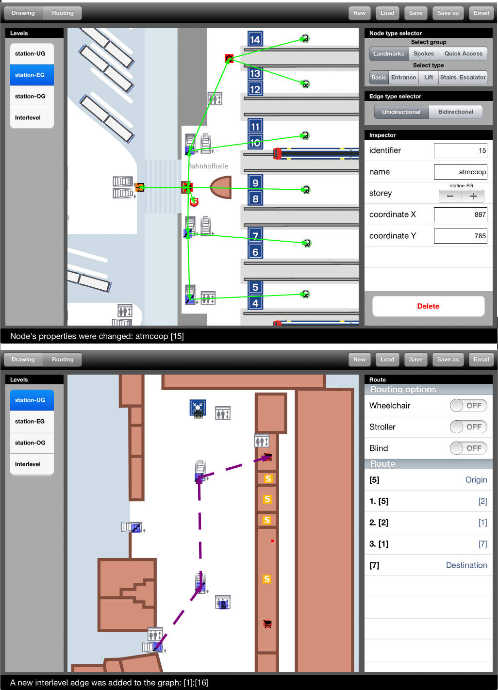 The Lucerne Station app is based on an editable route network accurate to within a meter and can be dynamically adapted according to current knowledge. This makes it possible to temporarily recommend a different route, for example if a special event is taking place.